
Finding Laguna Niguel Street Records
A street search should move from a physical address to a stable parcel identifier, then from the parcel to the records that actually use it. Laguna Niguel's Public GIS Viewer accepts a street address or APN. Its parcel popup can show the APN, zoning, General Plan designation, HOA, tract, lot, coordinates, and electric provider. Those fields make it possible to distinguish two similar street labels before looking for a person.
Once the parcel is fixed, the county assessed-value screen supplies value and exemption fields, while the recorder's APN or legal-description search supplies a recorded-document trail. A permit may add construction evidence. A voter file is a separate, restricted layer. A reverse directory, if a regional volume covers the address, adds a historical occupant snapshot. The chain is evidence by address, not a claim that every person at the parcel is named.
- Enter the street address in the city GIS and save the APN, tract, lot, HOA, and map position.
- Use the county Surveyor viewer when a tract map, parcel map, annexation layer, measurement, or road-right-of-way detail is needed.
- Run the APN through the assessed-value query and note the value components, exemption, and data-current date.
- Search the recorder by APN or confirmed party, then save the document number, date, roles, and legal description.
- Layer a permit, lawful voter-file route, newspaper, or directory source only when its purpose and coverage fit the question.
This sequence gives the address trail a repeatable spine. It also keeps a property fact from being mistaken for a current resident fact.
Laguna Niguel Address to APN
The Laguna Niguel Public GIS Viewer is the main address-to-parcel bridge. Search by street address, then select the parcel rather than relying on the map pin alone. The popup records the parcel number, tract, lot, zoning, General Plan designation, HOA, coordinates, and electric provider. Pan and zoom can expose the next parcels on the same road, which is useful when a question shifts from one address to a whole block.
| GIS control | Use in an address search |
|---|---|
| Address | Locate a street parcel from the mailing label |
| Parcel Number/APN | Return to a stable land identifier |
| Pan and zoom | Browse nearby parcels along a street segment |
| Parcel popup | Read APN, tract, lot, HOA, zoning, plan, coordinates, and utility provider |
| Thematic layers | Check apartments, condominiums, flood, General Plan, Gateway, HOA, fire, zoning, and evacuation context |
The map does not itself name an owner or occupant. It supplies the geography needed for a responsible county search. For a legal description or subdivision history, the Orange County Surveyor GIS adds tract, parcel, survey, annexation, time, and road-right-of-way layers. Keep the street label and APN together because a city label may not reflect the record's older jurisdiction.
The city's maps page is also the clearest way to see how HOA, tract, and lot context can change along a continuous-looking road.
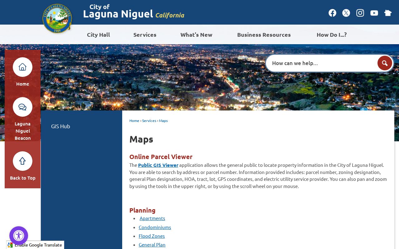
The GIS view anchors the rest of the address trail in a parcel, not just in text typed into a search box.
Laguna Niguel GIS Layers by Street
Laguna Niguel's road pattern is master-planned and hilly, with arterials, loops, cul-de-sacs, gates, and private streets rather than a simple numbered grid. The city map can show the planning side of a street. The county Surveyor viewer supplies a different set of tools: Record of Survey, Parcel Map, Tract Map, Corner Record, Lot Line Adjustment, Topographic Survey, Tie Book, and Alignment Note searches. It also includes Draw and Measure, Time Filter, Street View, city annexations, flood parcels, and assessor, tract, and survey layers.
Use the city viewer to understand the parcel's local setting. Use the county viewer when a boundary, recorded map, or historical jurisdiction matters. A road name may remain familiar while the legal description, tract, or annexation record carries the continuity. This is why a street directory built from only an address string can miss an earlier county-era record.
A useful map note includes the APN, tract, lot, HOA, and the layer used. It does not need a person's name. That makes it easier to hand the geography to the recorder or a city records clerk without asking either office to solve an identity problem.
What Laguna Niguel Records Show by Address
Address-keyed records have distinct roles. The city GIS locates the parcel and its planning context. The Assessor's value screen reports a narrow financial snapshot. The recorder index identifies parties to recorded documents. The Permit Center can expose project and inspection evidence where public. A voter file can contain residence fields only through an approved statutory purpose. A reverse directory may show a historical address-to-occupant entry if the right regional volume exists.
| Record set | Keeper | What it shows | Access |
|---|---|---|---|
| City parcel GIS | Laguna Niguel | APN, tract, lot, HOA, zoning, plan, coordinates | Free address/APN viewer |
| Assessed value | Orange County Assessor | Land, improvement, exemption, and net value fields | Free APN query |
| Recorded documents | Orange County Clerk-Recorder | Party roles, type, date, instrument or book/page | Free index; copies ordered separately |
| Permits | Laguna Niguel Permit Center | Application, status, inspections, and project evidence where public | Online route plus city request fallback |
| Voter data | Orange County Registrar | Released residence and election fields for a qualifying purpose | Statutory application only |
The APN is the bridge between the city parcel and county title material. The street name is helpful for orientation, but the recorder does not offer a street-address search. A complete street directory therefore collects APNs first and searches each one.
The Laguna Niguel APN-Only Value Screen
The official assessed-value query accepts one APN, shown as 999-999-99 with punctuation removed for the required eight digits. Its returned fields are APN, land, buildings and improvements, other improvements, personal property, total assessed value, exemption, net value, and the date the data were current. The inspected screen did not expose owner name, mailing address, situs address, occupant names, deed image, or full sales history.
The county property-information page routes users toward ParcelQuest or the Public Service Counter, with a disclaimer around the outside service. Roll products can require a counter or focused written request. The research lists prices for parcel maps, index maps, roll pages, copies, certification, and comparable-sales output. A street directory should state those routes plainly rather than promise a free owner-name result that the value page does not provide.
The Orange County assessed-value screen is the direct APN tool.
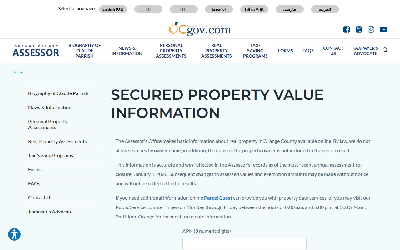
The value result answers what is assessed to the APN. It does not answer who occupies every unit at the address.
- Situs address
- The physical location of the parcel, which can differ from the place assessment notices are mailed.
- Mailing address
- The destination for notices or correspondence, which may be a trust, manager, or another location.
- Plat
- A recorded map that shows lots, streets, and subdivision geometry.
- Criss-cross directory
- A reverse directory that may connect an address or telephone to a named occupant for a particular historical edition.
Laguna Niguel APN to Deed Trail
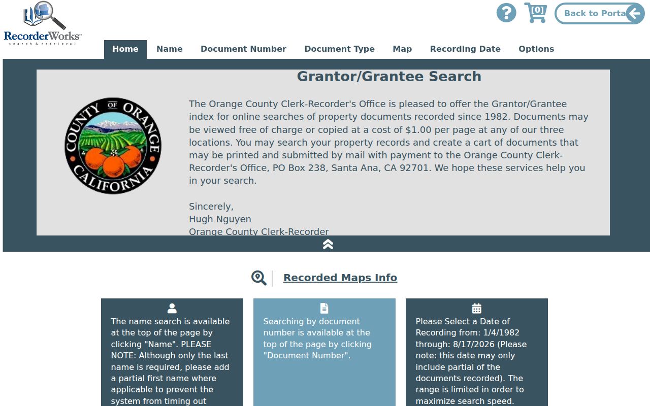
Search the Orange County Grantor-Grantee Index by APN when the mode is available, or by the confirmed party. Record the role, document type, recording date, instrument number, book and page where shown, APN, and legal description. A grantor is the transferring party. A grantee receives the interest. That distinction tells the next search where to look.
Online index coverage starts January 4, 1982. Before that date, older instruments are on microfiche at the Santa Ana office and the reference normally depends on book, page, and instrument details. The public index does not supply free document images. Copies are ordered after the identifier is known, with the county's stated per-page and certification charges.
Clicking a party name can bring up connected indexed documents from 1982 forward. That is a useful way to expand a confirmed title trail, but it does not turn the recorder into a street roster. A lien party, trustee, lender, or former owner may have no present connection with the address.
The official copy-order instructions explain why the identifier must be resolved before a paid copy request.
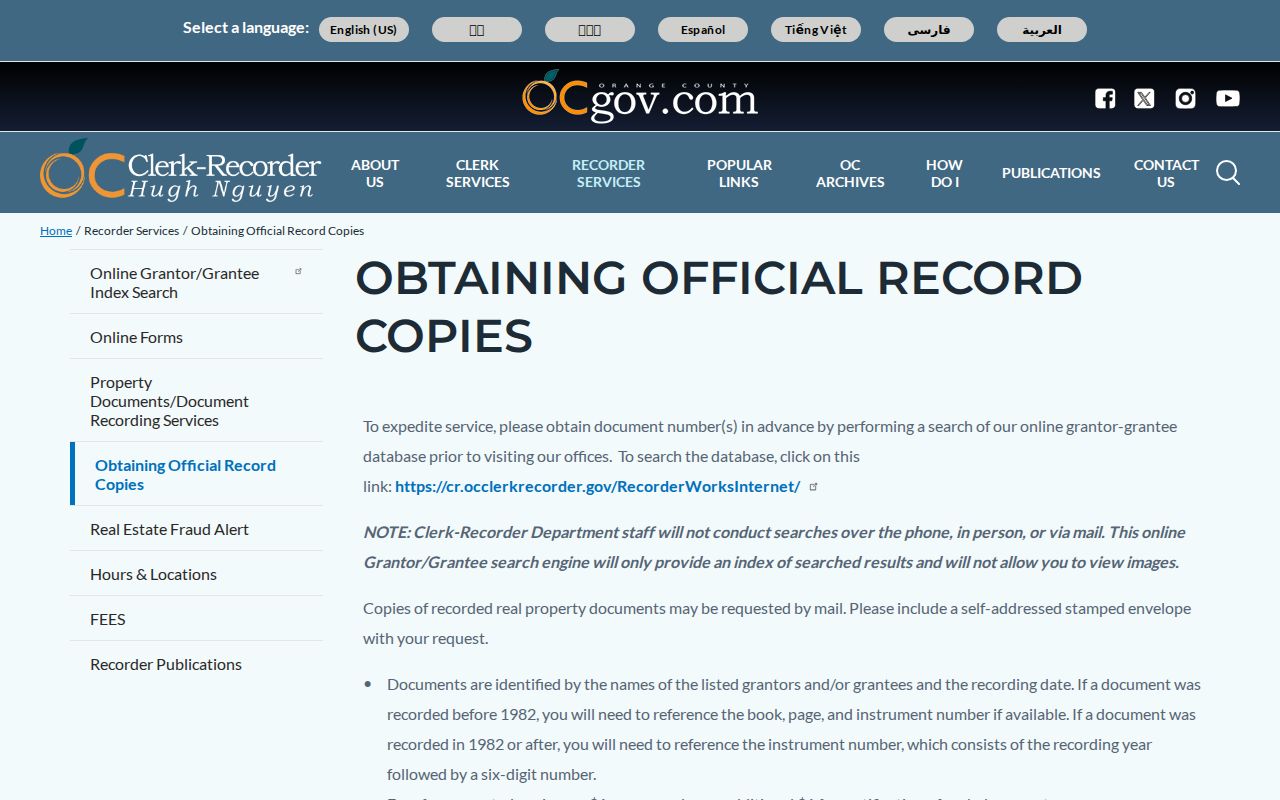
Use the copy route for a document that materially resolves the parcel history, not for a broad request for every name on a street.
Laguna Niguel Permits Add Date Clues
The Laguna Niguel Permit Center advertises Apply Online, Pay Fees, Permit Status, Daily Inspection List, Permit History, and inspection scheduling. Registration asks for an email, name, phone, password, emailed code, and additional fields. An account adds application and dashboard functions. The public portal should be inspected for the individual permit before claiming that a particular owner, contractor, or applicant field is visible.
When a public permit result is not available, the city building-plan form asks for the requestor, property address, property type, tract, and year built. The research states that pre-1989 plans are not held by the city. That cutoff matters for a street directory because Laguna Niguel's subdivisions began before incorporation and the earlier plan record belongs to county-era research.
The city warns that it will not request payment by email, wire, cryptocurrency, or payment apps. Treat a permit message as a record-routing clue, then confirm through the city phone or official portal.
The Laguna Niguel Permit Center shows the account and status workflow.
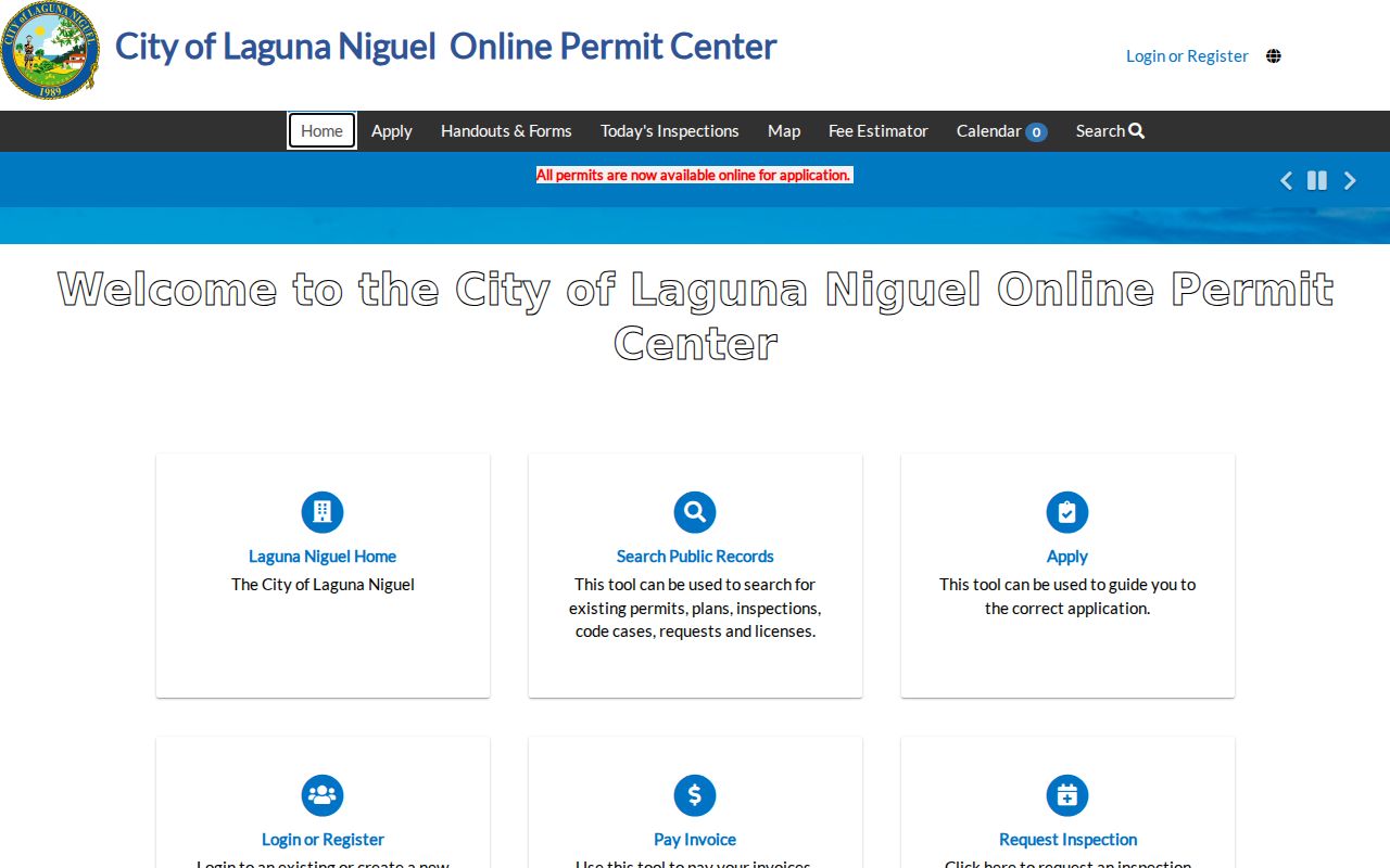
Permit dates can place construction or inspection activity along a street, but they do not identify every household member.
Laguna Niguel Street History Needs Context
The main continuity change is jurisdiction, not a verified citywide street-renumbering event. Before December 1989, the land was unincorporated Orange County. The planned community grew from the 1959 plan, with Monarch Bay and Laguna Terrace sales beginning in 1961 and later tract phases following. Search older material under Rancho Niguel, Orange County, tract and lot, or legal description instead of assuming the modern city label was always used.
The city history page identifies the Rancho Niguel, Moulton Company, planned-community, and incorporation sequence. A street directory can use that sequence to decide when city records begin and when county records must carry the search. The APN, tract, and legal description are stronger bridges than a mailing city when an old record uses different geography.
The Orange County Grantor-Grantee Index is the source for the deed-index view used in this part of the street directory.
The historical context keeps a pre-city address from being discarded as a bad modern search result.
Reverse Directories on Laguna Niguel Streets
Regional telephone and criss-cross volumes may help identify a past occupant by address, but the local research contains an important gap: no official catalog page verified exact publishers, inclusive years, reverse sections, or a representative Laguna Niguel entry. Orange County Archives confirms county directories as a collection category. OCPL staff can help identify a volume that actually covers the tract and year.
Ask for the title and publisher, the first and last year held, whether a reverse section exists, and whether a researcher may photograph or obtain a scan of a representative address entry. Until those questions are answered, describe the collection as a lead rather than a guaranteed lookup. A directory entry is also a snapshot, not proof of continuous residence between editions.
The historical shelf belongs to the Laguna Niguel city directory collections page. A current street chain belongs with GIS, APNs, deeds, and permits.
What Laguna Niguel Streets Cannot Show
An address record can show parcel geography, an owner or deed party, a permit participant, or a properly released voter field. It does not reveal every adult, child, visitor, non-owner occupant, utility customer, or protected participant connected to the address. DMV address information is restricted under the federal Driver's Privacy Protection Act. The city map and county property tools do not create a complete household list.
The voter file is also purpose-limited. California Elections Code §2194 permits controlled release for election, scholarly, journalistic, political, or governmental purposes and prohibits personal, commercial, marketing, and harassment uses. My Voter Status is an identity-gated self-lookup. It is not a tool for browsing a Laguna Niguel street by name.
Lawful personal use. Use address records for family history, property research, civic understanding, or personal safety awareness. Do not use a street directory to stalk, harass, intimidate, or harm anyone.
When the goal shifts from a whole street to one person, a distinct Laguna Niguel resident lookup workflow is more accurate. It starts with the record that can confirm the relevant fact and uses a second identifier.